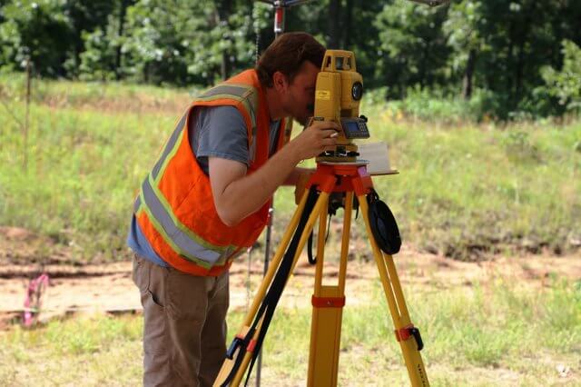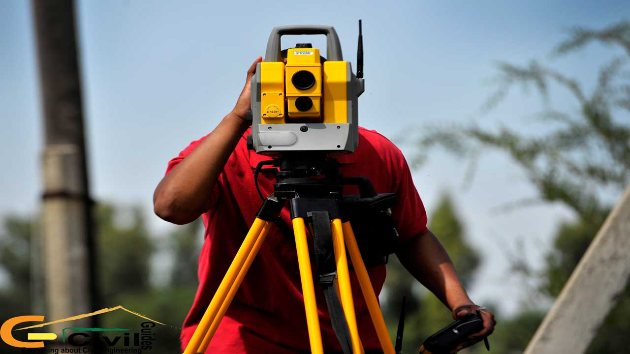
A theodolite survey is a method used to measure highly accurate horizontal and vertical angles, distances and elevations with precision. This technology has developed over centuries, evolving into an increasingly dependable and accurate method. It is essential in civil engineering, construction, and land surveying due to its efficiency in defining boundary lines, positioning points, and mapping sites. Theodolite surveys are vital in creating topographic maps, planning infrastructure, and establishing site layouts. Technological advancements have made theodolite surveying more efficient, ensuring reliable data collection supporting various applications.
However, its operation can be complex, requiring a skilful setup and an in-depth understanding of its components to ensure optimal accuracy. This comprehensive guide offers a breakdown of theodolite surveying, covering its types, methods, principles, operations and uses of theodolite in surveying.
What is Theodolite?
To understand what exactly is a theodolite survey, it's helpful to first understand the instrument — a theodolite. A theodolite is an optical instrument that measures horizontal and vertical angles between two points. This instrument is fundamental in theodolite surveying, enabling surveyors to calculate distances, elevations, and coordinates with high precision. Modern theodolites often incorporate electronic technology, such as total stations, which integrate angle and distance measurements with GPS data, enhancing surveying accuracy and efficiency.
Theodolites have been essential in developing urban landscapes, from mapping terrain to constructing bridges and skyscrapers. Their role in surveying makes them a staple for any professional in the field of geospatial measurements and civil construction.
Types of Theodolite Survey
There are primary two types of theodolite surveys — transit theodolite survey and non-transit theodolite survey.
Transit Theodolite: This survey uses a transit theodolite, where the telescope can be rotated completely about its horizontal and vertical axes, providing a broad range of measurements. This versatility makes it ideal for extensive land surveys and engineering applications where precise angle measurement is necessary.
Non-Transit Theodolite: In this type, the telescope cannot be inverted. Non-transit theodolites are simpler in design and are typically used for simpler angular measurements. However, they are less commonly used in modern surveying due to limited flexibility compared to transit theodolites.
Theodolite Category: Theodolites can be classified into two categories based on the type of scale used. The first category is vernier theodolites, which are mounted on a vernier scale and commonly used in routine surveying tasks. The second is micrometre theodolites, which are mounted on a micrometre scale.
Methods Used in Theodolite Survey

Theodolite surveys involve various methods to obtain accurate measurements. Among these, the repetition method in theodolite surveying and the reiteration method in theodolite surveying are the most common.
1. Repetition Method in Theodolite Surveying
This method involves measuring the same angle multiple times and averaging the results to reduce errors caused by instrument imperfections or human error. By repeating measurements in both direct and reverse positions, surveyors ensure greater accuracy, making it suitable for precise construction projects.
2. Reiteration Method in Theodolite Surveying
The reiteration method involves setting up the theodolite at a fixed point and measuring multiple angles in a circular sequence around a central point. This method is particularly useful when measuring numerous angles from a single station, such as in mapping and layout surveys. It ensures that all angle measurements align around the fixed station, providing a consistent and reliable survey.
3. Direction Method in Theodolite Surveying
The direction method in theodolite surveying involves setting up the theodolite at a station and measuring angles relative to a fixed reference line. Surveyors can accurately measure angles to multiple points from the same station by using a single direction as a baseline, minimising cumulative errors. This method is especially useful for road alignments, site layouts, and mapping.
Principles of Theodolite Survey
Theodolite surveys rely on several fundamental principles to achieve precision and reliability. These principles are essential in obtaining reliable data, allowing surveyors to minimise common errors and maintain precision in their work. You can find the details of each of them below:
1. Line of Sight (Collimation Line)
The line of sight, or the collimation line, is the imaginary line passing through the centre of the theodolite’s telescope and focused on a specific point. For accurate angle measurement, this line must be perfectly level and unobstructed. Any tilt or obstruction can lead to incorrect readings and distort the survey results. Proper alignment ensures that the angles between survey points are accurately measured, which is critical in establishing reference lines and boundaries.
2. Horizontal and Vertical Rotation
The theodolite’s telescope can rotate on horizontal and vertical axes, which is essential for measuring both horizontal and vertical angles. This dual-axis rotation allows surveyors to observe a broad field of view, adjusting angles precisely in all directions. The horizontal rotation enables the measurement of bearings or directions between points, while vertical rotation allows for elevation or inclination measurements. These adjustments facilitate comprehensive mapping and plotting in diverse terrains and structures.
3. Parallax Error Minimisation
Parallax error occurs when the image of an object shifts relative to the reticle (crosshairs) of the telescope, often due to improper focusing. This error can introduce slight distortions in readings, affecting the accuracy of measurements. To minimise parallax error, surveyors carefully adjust the telescope's focus, ensuring that the reticle and the object observed are in sharp alignment. Minimising parallax error is important for accurate and repeatable measurements, particularly over long distances.
4. Alignment with True North
Aligning the theodolite with a true north or an established reference line provides a consistent orientation for all measurements. This alignment is crucial in larger surveying projects, as it enables the integration of multiple measurements into a cohesive, accurate framework. By establishing a standard reference direction, surveyors can cross-reference data from different points, ensuring that all measurements align with a common axis. This practice is especially important for creating accurate maps, layouts, and geographic models.
5. Centring and Levelling
Centring and levelling involve positioning the theodolite precisely over the survey point and ensuring that it is level. Centring means aligning the theodolite directly over a marked ground point, typically using a plumb bob or laser. Levelling ensures the instrument is perfectly horizontal, allowing for accurate angle measurements. These steps are crucial for precision, as any misalignment can lead to errors that affect the survey’s accuracy, especially in projects requiring high precision, like construction layouts or boundary determinations.
Also Read: Leveling in Surveying: Types, Methods & Instruments Used
Instruments Used in Theodolite Survey
Theodolite surveys depend on a set of essential instruments, each contributing to accurate and reliable measurements. Here’s a closer look at each one of them:
1. Theodolite Survey Instrument
The theodolite survey instrument is the central tool in surveying, typically a transit theodolite designed to measure horizontal and vertical angles with precision. The theodolite consists of a telescope mounted on a swivel mechanism, allowing for angular adjustments on both axes. Modern theodolites often come equipped with advanced features, such as GPS integration and electronic angle-measuring capabilities, which enhance accuracy and streamline data collection. These enhancements are particularly useful for large-scale or high-stakes projects, such as construction, road planning, and land boundary surveys.
2. Tripod

A stable tripod supports the theodolite, ensuring it remains firmly in place during measurements. Even slight shifts or vibrations can lead to inaccuracies, so the tripod must be sturdy and correctly positioned. Tripods are usually adjustable, allowing the surveyor to adapt to different terrain conditions and maintain a level base for the theodolite. This stability is essential for ensuring that all angular measurements are accurate and repeatable, particularly when dealing with uneven or challenging surfaces.
3. Plumb Bob
The plumb bob is a small, weighted tool suspended from a string that aligns the theodolite directly over the survey point on the ground. By ensuring vertical alignment, the plumb bob helps accurately position the instrument over a fixed reference point, minimising errors in spatial orientation. Proper alignment is critical for maintaining measurement consistency, particularly when multiple points are surveyed and combined into a single map or layout.
4. Leveling Staff
The levelling staff is a graduated rod used with the theodolite to measure height differences and vertical angles. This tool is especially useful for determining elevation changes between points on sloped or uneven terrain, contributing to a three-dimensional understanding of the area being surveyed. The levelling staff is essential for topographical surveys, where understanding the rise and fall of the land is necessary for planning structures, drainage systems, and road layouts.
5. Compass
The compass is often used alongside the theodolite to orient the instrument to a true north or a known reference direction. By establishing a consistent directional reference, the compass aids in taking precise bearings, helping surveyors align the theodolite accurately for angle measurements. This alignment with true north is particularly valuable in mapping and geospatial projects, where measurements from different survey stations must be consistent with a common direction to form an integrated and accurate layout.
Together, these instruments form the foundation of theodolite surveying, allowing surveyors to capture precise and consistent data. Each tool plays a vital role in achieving reliable results, from establishing a stable setup with the tripod and plumb bob to measuring angles and elevations with the theodolite and levelling staff.
Also Read: What is Geodetic Survey: Its types, methods and Uses
Uses of Theodolite in Surveying

Theodolite surveys have broad applications across various industries due to their ability to provide precise measurements. Below are some of the essential uses of theodolite in surveying:
1. Topographic Surveying

Theodolites are crucial in creating detailed topographic maps that represent the contours, elevations, and natural features of a given area. These maps are essential for land use planning, construction, and environmental assessment. By accurately measuring angles and elevations, theodolites allow surveyors to capture complex terrain shapes, ensuring that developers and planners have accurate data for designing infrastructure, assessing environmental impact, and managing land resources effectively.
2. Construction Site Layouts
In civil engineering, theodolites are essential in setting out precise locations for structures, roads, bridges, and other key elements of a construction project. The instrument helps ensure each component is placed according to the project’s design specifications. Theodolites ensure alignment and structural integrity by measuring exact angles and distances, reducing the risk of costly errors or misalignments. This accuracy is particularly important in large-scale projects, where slight misplacements can lead to structural instability or safety hazards.
3. Boundary Surveys
Boundary surveys rely on theodolites to define and verify property lines, providing the necessary precision to avoid disputes and establish clear ownership limits. Theodolites help ensure that property boundaries are properly marked and documented by accurately measuring angles between established boundary points. This application is important for legal purposes, preventing conflicts between property owners and assisting with land transactions, land division, and property development.
4. Roadway and Railway Engineering

In transportation engineering, theodolites are used to set out the curvature, grades, and alignments required for roads and railway lines. Accurate angle and distance measurements are essential for designing safe, efficient, and well-constructed transportation routes. Theodolites enable engineers to calculate the necessary curves, slopes and turns, minimising risks such as sharp curves that could lead to accidents. This data is also used to optimise the efficiency of transportation routes, contributing to better traffic flow and reduced travel times.
5. Geodetic Surveying
Geodetic surveying involves measuring large areas of land, often over long distances. Theodolites are indispensable in this type of surveying, as they provide the precision needed to establish control points on the earth’s surface, typically for government mapping, scientific research, and global navigation systems. Geodetic surveys support mapping and data collection efforts on a national and international scale, ensuring that geographic information is consistent, accurate, and can be used for various applications, including environmental monitoring and urban planning.
6. Mining Surveys
In mining, theodolites are used to survey underground shafts, tunnels, and open-pit mines, providing precise measurements of angles and distances to guide excavation and ensure safety. Accurate measurements help in planning excavation paths, determining the volume of materials, and monitoring any shifts in rock formations. Using theodolites, engineers can ensure that mining operations proceed within planned boundaries, reducing risks associated with tunnel collapses or encroaching on restricted areas.
7. Archaeological Site Mapping
Theodolites assist archaeologists in creating accurate maps of excavation sites, documenting the exact positions and alignments of structures and artefacts. By mapping the site precisely, archaeologists can record the spatial relationships and orientations of historical features, which are essential for analysis and preservation. Theodolites help ensure that site plans are detailed and reliable, aiding research and restoration efforts and preserving valuable historical and cultural information.
Conclusion
Theodolite surveys form the backbone of accurate land measurements. With advanced methods like repetition and reiteration, theodolite surveys minimise errors, providing precision that aids in everything from property demarcation to infrastructure development. Theodolite instruments and techniques have evolved with technology, but the core principles remain rooted in accuracy and consistency. As surveying continues to advance, theodolite surveys will remain integral to capturing the data that shape our built environment.
If you're curious about the theodolite survey and want to learn more about it, explore the BIM Professional Course for Civil Engineers offered by Novatr and see how it aligns with your professional aspirations.
For more information on civil engineering and related topics, head to our Resources Page.
Frequently Asked Questions
1. What are the main types of theodolites?
The two main types of theodolites are transit and non-transit theodolites. Transit models allow the telescope to rotate fully, making them suitable for precise engineering surveys. Non-transit models offer basic angle measurement but are less flexible and rarely used today.
2. How do repetition and reiteration methods differ?
The repetition method measures the same angle several times and averages the readings to reduce random errors. The reiteration method measures multiple angles around a point in sequence to achieve balanced and consistent observations.
3. Which instruments are used with a theodolite in the field?
Common instruments include a tripod for stability, a plumb bob for centering, a leveling staff for elevation readings, and a compass for orientation. Together with the theodolite, they support accurate horizontal and vertical angle measurement.
4. What temporary and permanent adjustments are needed?
Temporary adjustments include centering, levelling, and focusing the telescope. Permanent adjustments involve aligning the optical axis, correcting the line of sight, and ensuring the horizontal and vertical circles read accurately.
5. What errors affect theodolite measurements and how can they be minimised?
Theodolite measurements may be affected by instrument faults, parallax, imperfect leveling, atmospheric conditions, and human sighting errors. These can be reduced by proper leveling, careful focusing, repeated readings, and regular instrument calibration.
Was this content helpful to you


.jpg)


