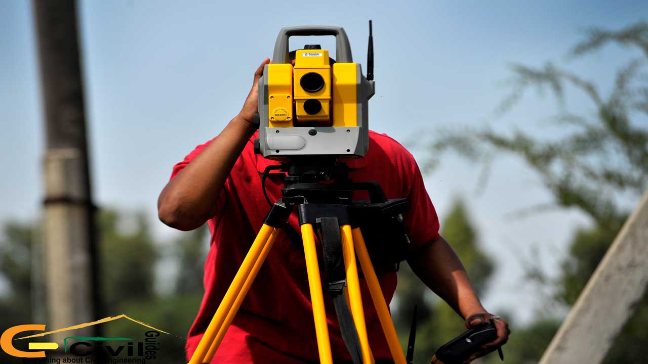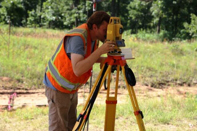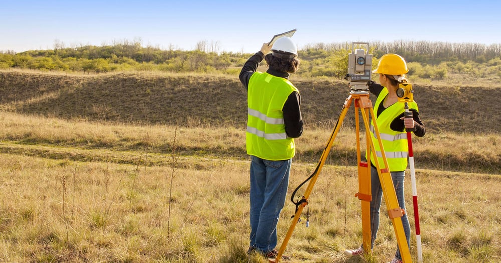
If you have ever wondered what is a geodetic survey or why it is crucial for large-scale mapping, you are not alone. Unlike basic surveying, geodetic surveying accounts for the Earth’s curvature, allowing for precise measurements over vast distances. The geodetic surveying definition includes specialised methods to measure and map the Earth accurately, which is essential for projects that demand high accuracy, like GPS and satellite systems.
In this guide, we will explore what geodetic surveying is, how it works, and the key ways it is used in mapping and infrastructure.
What is a Geodetic Survey?
Geodetic surveying is a method of surveying that takes into account the Earth's curvature to measure large areas accurately. Unlike plane surveying, which assumes the Earth is flat, geodetic surveying applies mathematical models of the Earth's shape and size, making it ideal for mapping extensive regions, establishing precise locations, and supporting global positioning systems (GPS).
In simple terms, the geodetic surveying definition involves understanding the Earth's geometry and gravitational forces to determine accurate positions and elevations over large distances. This approach is critical for national mapping projects, infrastructure development, and satellite positioning systems worldwide.
Some of the common examples of Geodetic survey are Control Surveys, Topographic Surveys, Boundary Surveys, Hydrographic Surveys, Cadastral Surveys and Astronomical Surveys.
Different Types of Geodetic Surveys
Below, we will explore the types of geodetic surveying, highlighting their techniques, instruments, and specific uses.
1. Control Survey
A Control Survey is foundational in geodetic surveying, establishing a network of reference points that other surveys rely on. These surveys provide a coordinate system for accurate positioning, allowing other types of surveys to use these benchmarks for their specific measurements. Through control surveys, accurate frameworks are created using advanced geodetic survey techniques and instruments like theodolites and GNSS receivers. This type of survey is critical in geodetic surveying in civil engineering, where foundational reference points are essential for aligning and positioning large infrastructure projects.
2. Topographic Survey
Another widely used type is the Topographic Survey, which maps out the physical features and elevation changes of an area. This survey focuses on capturing details like hills, valleys, rivers, and buildings, providing a complete representation of the landscape’s shape. By utilising GNSS and total stations, topographic surveys gather both horizontal and vertical data on natural and constructed features. This data is invaluable for urban planning, landscape design, and infrastructure projects, making topographic surveys one of the most versatile types of geodetic surveying. The information gathered assists in creating detailed terrain models, which are essential for civil planning, flood control, and assessing natural resources.
3. Cadastral Survey
A Cadastral Survey focuses on establishing property boundaries. This survey is especially critical in legal and land ownership contexts, as it precisely defines property limits and plots land parcels for taxation, land registration, and ownership verification. This geodetic surveying is used for these purposes to ensure accuracy in boundary demarcations, which is vital for resolving disputes and documenting land ownership rights. These surveys are commonly employed in real estate and government land administration, and they contribute to accurate land records for both public and private sectors.
4. Engineering Survey
These types of surveys are specifically geared toward supporting construction and infrastructure projects. It assists in designing roads, bridges, dams, and other major structures by providing detailed measurements of both surface and subsurface conditions. Geodetic survey techniques are applied to ensure that measurements are precise and reliable, which is particularly important in structural engineering projects where stability and alignment are crucial. Engineering surveys use tools like levels, GNSS, and total stations to gather accurate data on elevation, gradient, and alignment, helping engineers design and construct infrastructure safely and effectively.
5. Hydrographic Survey
It is another important type, focused on mapping underwater features and measuring water depths. It’s primarily used for navigation, coastal engineering, and underwater construction projects. By employing sonar, echo sounders, and other specialised geodetic survey instruments, hydrographic surveys produce precise maps of riverbeds, ocean floors, and other bodies of water. This type of survey is critical for dredging, pipeline placement, and ensuring safe navigation for ships, providing a geodetic survey example that supports both commercial and environmental needs.
6. Astronomical Survey
Lastly, an Astronomical Survey is conducted by observing celestial bodies to determine precise locations on Earth. Historically significant, astronomical surveys were used to establish initial points in early geodetic networks and are still valuable in research and navigation. Observations of stars and planets help establish reference points, and although satellite-based systems have taken over many of these functions, astronomical surveys still support global positioning systems and scientific research. By using telescopes and observational tools, astronomical surveys aid in refining geographic coordinates and enhance our understanding of the Earth’s place in space.
Also Read: Plane Vs Geodetic Surveying : What To Use?

Key Methods in Geodetic Surveying
To understand what is geodetic survey and its methods, let’s explore these essential techniques that help achieve the core objectives of geodetic surveying.
1. Triangulation
This method uses a network of triangles to calculate distances and angles across vast distances. It is fundamental in understanding what is surveying in geography as it provides precise locations by measuring a few key points and then calculating others using trigonometry. Triangulation is widely used in boundary mapping and creating geographic databases.
2. Trilateration
Similar to triangulation, trilateration uses distance measurements instead of angles to establish points on the Earth’s surface. With advancements in GPS technology, this method has become highly accurate, making it a common tool in real-time navigation and satellite positioning, demonstrating key uses of geodetic surveying.
3. Levelling
This technique focuses on measuring elevation or height between points, which is essential in projects where consistent elevation is crucial, such as in road construction and flood management. Levelling is invaluable in geodetic surveying for establishing reliable reference points in construction and topographic studies.
Uses of Geodetic Survey
Geodetic surveying is essential for measuring and mapping large areas with high accuracy, particularly over distances where the Earth’s curvature must be considered. Understanding what is geodetic survey involves looking at its diverse applications, from mapping to construction and environmental monitoring.
-
Geodetic surveying provides the foundation for creating accurate geographic maps, supporting global navigation and GPS systems by establishing precise locations worldwide.
-
In geodetic surveying in civil engineering, it is critical for planning large-scale infrastructure projects like highways, bridges, and tunnels, ensuring accurate alignment and stable foundations.
-
Geodetic surveys play a significant role in environmental management by monitoring natural phenomena, such as tectonic shifts and erosion, which helps scientists study changes in the Earth’s surface and predict natural disasters.
-
Through cadastral surveys, a geodetic survey example in property boundary determination, geodetic surveying supports land ownership records, enabling precise documentation and dispute resolution.
-
The objectives of geodetic surveying also include tracking sea level changes and understanding the Earth’s gravitational field, contributing valuable data for scientific research and sustainable development projects.
Also read - Theodolite Survey: Its Types, Methods and Uses
Core Principles of Geodetic Survey
The core principles of geodetic surveying are essential for achieving accuracy when measuring and mapping large areas. These principles make geodetic surveying crucial in fields like mapping, construction, and global navigation.
-
Coordinate Systems and Datums: Using specific coordinate systems and datums, geodetic surveys make it possible to measure and compare data accurately on a global level. This is important for applications like mapping in global positioning.
-
Considering Earth’s Curvature: Unlike regular surveying, geodetic surveying takes into account the Earth’s curvature. This allows for more accurate measurements across large distances and is key to understanding what is surveying in geography on a global scale.
-
High Accuracy Measurements: Geodetic surveying is used for highly accurate measurements. Advanced geodetic survey instruments, such as GPS and theodolites, ensure precise data, which is vital for large-scale projects, especially in geodetic surveying in civil engineering.
-
Using Advanced Techniques: Geodetic surveying involves specialised methods like triangulation, trilateration, and satellite-based measurements. These geodetic survey techniques allow for detailed data collection across wide areas.
-
Setting Control Points: A network of control points is created in geodetic surveys. These fixed points provide a reference system for further measurements, allowing for consistent and reliable data across regions.

Techniques Used in Geodetic Surveying
Here are the primary geodetic survey techniques that help meet the objectives of geodetic surveying and support applications in various fields, from navigation to civil engineering. Each of these types of geodetic survey techniques plays a vital role in achieving the accuracy required for modern projects.
1. Triangulation
It is one of the oldest and most commonly used geodetic survey techniques. It involves creating a series of triangles to measure distances and angles between points. By starting with a baseline of known length, surveyors can calculate other distances and angles through trigonometry. This technique is especially useful for large-scale mapping and boundary surveys, and it helps establish control points that serve as references for further measurements.
2. Trilateration
This process focuses on measuring distances instead of angles. Using known distances from at least three reference points, this technique determines precise locations. Trilateration is widely used in geodetic surveying in civil engineering projects where high accuracy is required. With modern tools like GPS, trilateration has become even more efficient, making it essential for precise mapping and navigation.
3. Gravimetric Surveying
This surveying measures variations in the Earth’s gravitational field. This technique is used to study the Earth’s density and mass distribution, which can impact elevation models and support projects in geophysics and engineering. By understanding gravitational variations, surveyors can make accurate adjustments in mapping and infrastructure projects, especially in regions with unique geological formations.
4. GNSS (Global Navigation Satellite Systems)
GNSS, which includes systems like GPS, GLONASS, and Galileo, has revolutionised types of geodetic surveying by allowing precise data collection from satellites. GNSS technology is invaluable for gathering accurate, real-time positioning data over large areas, making it suitable for applications in mapping, environmental monitoring, and geodetic surveying in civil engineering. GNSS has made it possible to gather data with minimal ground equipment, which is particularly helpful in difficult-to-access areas.
5. Levelling
It is a technique focused on measuring height differences between points. It is fundamental for projects that require precise elevation data, such as road construction, flood control, and land development. Geodetic surveying is used for levelling to establish accurate elevations that are crucial in infrastructure and environmental projects. Digital levels and spirit levels are common geodetic survey instruments used in this technique, ensuring that the data collected is highly reliable.
6. Astronomical Positioning
It is one of the oldest geodetic survey techniques, where surveyors use observations of celestial bodies to determine precise points on Earth. By measuring the positions of stars and planets, surveyors can calculate coordinates with high accuracy. Though it has become less common with the advent of satellite technology, astronomical positioning is still valuable for specific applications like navigation and scientific research, especially in remote areas.
7. Photogrammetry
This method involves using aerial photographs or satellite images to measure and map the Earth's surface. By analysing the images and applying mathematical calculations, surveyors can create accurate models of the landscape. This technique is especially useful for mapping large and remote areas, allowing surveyors to capture details without being on the ground. Photogrammetry is a valuable geodetic survey example for producing detailed topographic maps and land use plans.
8. Remote Sensing
It is a modern technique that uses sensors on satellites or aircraft to collect data about the Earth’s surface. This technology captures data related to land use, vegetation, water bodies, and more, making it an essential tool in environmental studies and urban planning. Remote sensing is particularly valuable because it allows for continuous monitoring and can cover vast areas in short periods. It supports the objectives of geodetic surveying by providing consistent, up-to-date data.
Related Read: Ultimate List of Types of Survey in Civil Engineering
Conclusion
A geodetic survey is essential for accurately mapping large areas by accounting for the Earth's curvature. From precise boundary determination to infrastructure planning and environmental monitoring, geodetic surveying enables accurate and reliable data collection for diverse applications. The methods ensure high precision and play a vital role in projects across civil engineering, construction, and scientific research.
For civil engineers looking to expand their skills in advanced technologies, the BIM Professional Course by Novatr is highly beneficial. This course equips aspiring engineers with knowledge in Building Information Modeling, an essential tool for streamlining construction projects, improving accuracy, and enhancing collaboration.
For the latest insights and updates on the AEC industry, you can explore Novatr's Resource Page!
Was this content helpful to you


.jpg)