 Thanks for connecting!


Pragya Sharma
11 min read
April 30, 2024


Table of Contents

Geotechnical engineering is quite literally the bedrock of civil engineering. It delves into the intricate relationship between soil, rocks, and the built environment, offering a profound understanding of the earth's subsurface characteristics. This engineering discipline tackles the challenge of understanding soil behaviour under various conditions to ensure the stability and durability of structures. With technological innovations in recent times, the use of BIM in geotechnical engineering has become more prominent.
Who are Geotechnical Engineers?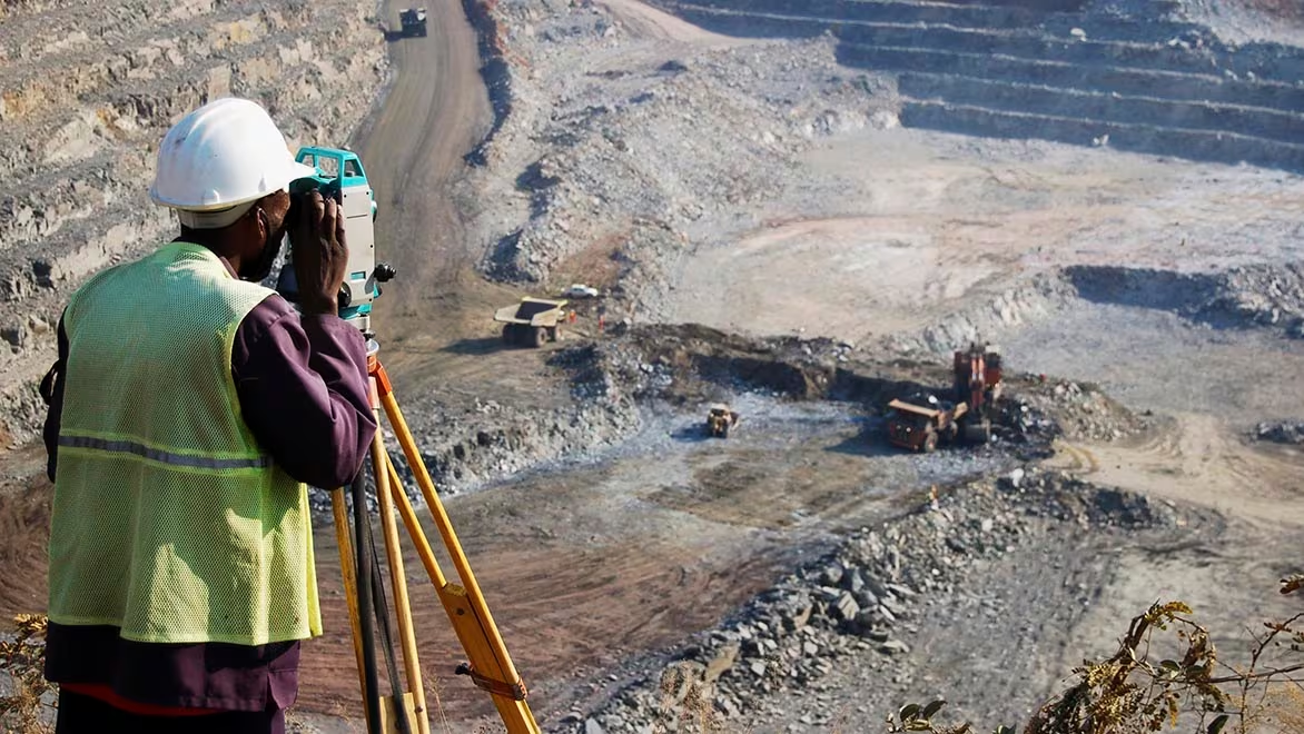
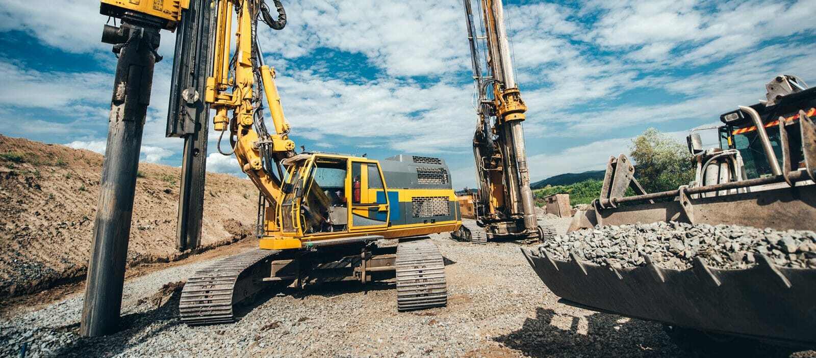
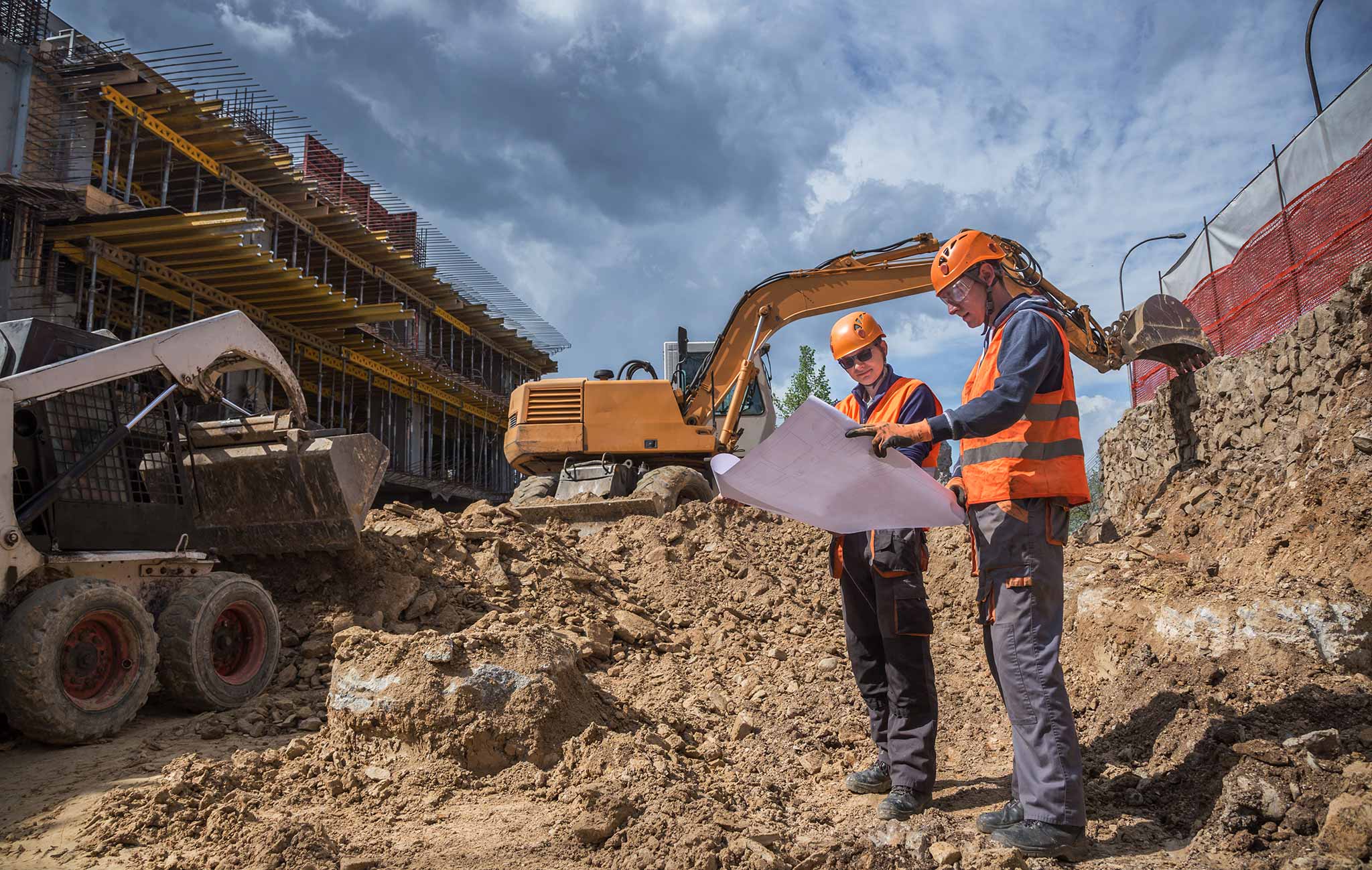
Geotechnical engineers investigate what's beneath the surface. They expertly study soil and rocks, using their geological knowledge and engineering skills. These professionals design foundations and structures that can withstand the dynamic forces underground.
1. Scope of Work of Geotechnical Engineers
- Analyse land conditions for construction projects
- Conduct thorough soil tests to assess feasibility and stability
- Advise on foundation designs to withstand dynamic forces
- Evaluate slope stability and manage earth retention systems
- Address potential hazards like landslides and other ground-related risks
- Monitoring and mitigating risks throughout the project execution on-site
2. Salary of Geotechnical Engineers
- United States: $69,000 - $1,00,000 per year
- United Kingdom: £27,000 - £38,000 per year
- United Arab Emirates: AED 1,20,000 - AED 2,40,000 per year
- India: ₹5,00,000 - ₹10,00,000 per year
What is Building Information Modelling (BIM)?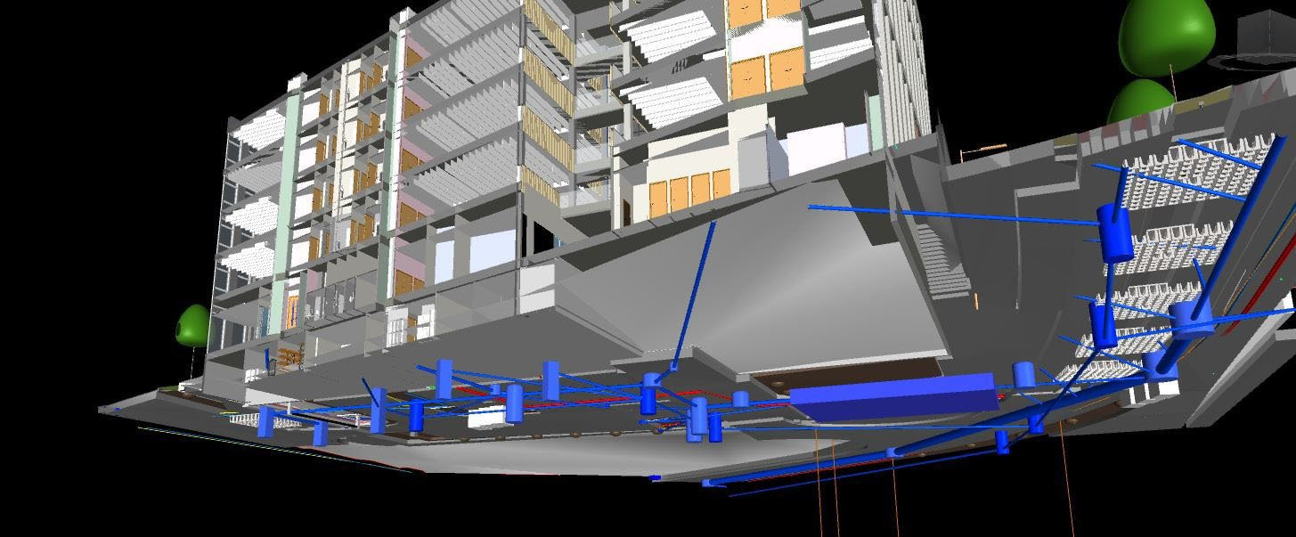
Building Information Modelling (BIM) is a digital 3D modelling technology that allows users to create detailed representations of their proposed structures. Engineers can edit the 3D models in real-time and have complete project information from materiality to structural details. This helps all stakeholders involved in a project to have a shared vision and avoid confusion in the execution stage.
Read more: Using BIM in Civil Engineering | Everything You Need to Know (2026)
Applications of BIM in Geotechnical Engineering

BIM technology is being used in various facets of the Architecture, Engineering, and Construction (AEC) industry. Various fields such as architecture, interior design, landscaping, urban design, civil engineering, structural engineering, and geotechnical engineering are embracing BIM to level up their professional game. Let’s explore the role of BIM in geotechnical engineering.
1. Holistic Site Analysis
BIM allows geotechnical engineers to conduct comprehensive site analyses by integrating geological data with 3D models. This enables professionals to assess subsurface conditions and accurately understand the terrain before the ground is even broken.
2. Efficient Data Management
Geotechnical projects involve vast amounts of data, ranging from soil composition to groundwater levels. BIM serves as a centralised platform, streamlining data management, and ensuring that all stakeholders have access to up-to-date and accurate information. This efficiency reduces the risk of errors and enhances collaboration among teams.
3. Risk Mitigation
BIM allows geotechnical engineers to simulate various scenarios, visualising the potential impacts of soil variations or geological events on the project. This capability facilitates proactive risk management by enabling the identification and mitigation of potential challenges before they become on-site issues.
4. Enhanced Collaboration
Geotechnical engineering often requires close collaboration with architects, structural engineers, and construction teams. BIM acts as a common language, fostering seamless collaboration by providing a shared platform for all stakeholders. It minimises communication gaps and promotes a more cohesive workflow.
5. Foundation Design Optimisation
The foundation is the backbone of any structure, and BIM empowers geotechnical engineers to optimise foundation designs through real-time collaboration and analysis. This results in more resilient structures that efficiently distribute loads and account for the dynamic nature of the subsurface environment.
6. Lifecycle Management
BIM extends its benefits beyond the construction phase, offering a valuable tool for the ongoing management of geotechnical assets. From monitoring soil conditions over time to assessing the impact of environmental changes, BIM provides a comprehensive solution for the entire project lifecycle.

Advantages of BIM in Geotechnical Engineering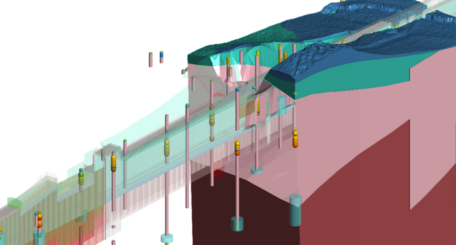
Given the advanced nature of BIM technology, it is proving highly beneficial for AEC projects. Let’s delve into the key advantages of BIM in the geotechnical engineering industry.
1. Improved Collaboration and Communication
BIM serves as a collaborative platform, fostering seamless communication among stakeholders involved in geotechnical projects. Architects, geotechnical engineers, and other project stakeholders can collectively contribute to a shared model, ensuring everyone works from the same information pool. This collaborative environment minimises miscommunication, reduces errors, and enhances overall project coordination.
2. Data Integration and Visualisation
Geotechnical engineering involves copious amounts of data, ranging from soil composition to geological surveys. BIM facilitates the integration of diverse data sets into a unified digital model. This streamlines the data integration process and provides a comprehensive visual representation of the subsurface conditions. Engineers can analyse and interpret this data more effectively, leading to informed decision-making throughout the project lifecycle.
3. Risk Management and Mitigation
BIM's simulation capabilities empower geotechnical engineers to model and assess various scenarios, allowing for proactive risk management. Professionals can identify potential risks before construction begins by simulating potential challenges, such as soil instability and groundwater issues. This early identification enables targeted mitigation strategies, reducing the likelihood of unforeseen issues and enhancing project resilience.
4. Data Management
Efficient data management is a cornerstone of successful geotechnical projects, and BIM excels here. It acts as a centralised repository, facilitating the organised storage and retrieval of critical geotechnical data. This enhances data integrity and ensures that accurate and up-to-date information is readily available to all project stakeholders.
5. Lifecycle Management and Maintenance
Beyond construction, BIM extends its advantages into the maintenance phase of geotechnical assets. Geotechnical engineers can use BIM to monitor changes in soil conditions over time, assess the impact of external factors, and make informed decisions for ongoing maintenance and rehabilitation efforts. This lifecycle management approach ensures the long-term sustainability of geotechnical structures.
Read more: Innovations That Will Transform Road Construction
BIM Tools and Technologies in Geotechnical Engineering

Geotechnical engineers use a vast array of BIM software to achieve more precise and sound structural solutions. Mentioned below are the most popular and useful software.
1. Autodesk Civil 3D
Autodesk Civil 3D offers robust tools for terrain 3D modelling, geospatial analysis, and design documentation. Geotechnical engineers can efficiently manage subsurface data, enabling them to make informed decisions throughout the project lifecycle.
2. Plaxis 3D
Geotechnical engineers working with BIM often turn to Plaxis 3D for its specialised focus on soil-structure interaction. This software allows for advanced finite element analysis, enabling engineers to simulate and analyse complex geotechnical scenarios. It empowers users to model various soil conditions and assess the impact on structures.
3. Bentley GeoStructural Analysis
Bentley GeoStructural Analysis has advanced modelling capabilities and allows engineers to design and analyse foundations, tunnels, and retaining walls. The software's integration with other Bentley products ensures seamless collaboration across disciplines.
4. Slide3
Developed by Rocscience, Slide3 focuses on slope stability analysis, making it a go-to BIM software for geotechnical engineers dealing with challenging terrains. The application employs limit equilibrium methods to assess the stability of slopes, providing critical insights for risk mitigation, and design optimisation.
5. gINT
Geotechnical professionals often turn to gINT, a Bentley Systems product, for efficient subsurface data management. This software streamlines the collection, analysis, and reporting of geotechnical data, enhancing collaboration and ensuring that critical information is readily available to all stakeholders throughout the project.
6. Autodesk Revit
Autodesk Revit stands out for its versatility and robust capabilities. While Revit is renowned for its prowess in architectural design, it seamlessly integrates with geotechnical engineering workflows. Its ability to create detailed 3D models empowers geotechnical engineers to visualise and analyse subsurface conditions comprehensively.
What are the Challenges of Using BIM in Geotechnical Engineering?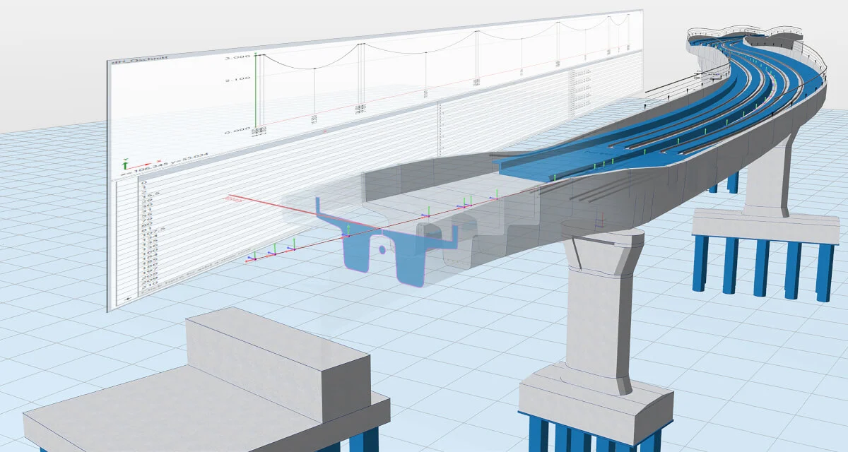
Implementing BIM technology in geotechnical engineering comes with benefits and challenges. And, while we’ve discussed the upsides, it is vital to map the difficulties in geotechnical BIM and how we can overcome them. Below are the fundamental challenges of embracing BIM in geotechnical engineering.
1. Data Interoperability Dilemma
One of the foremost challenges is the seamless exchange of data between various BIM platforms and geotechnical software. The intricate nature of geotechnical data demands a robust interoperability framework.
Solution
Embrace open standards and protocols that facilitate smooth data exchange. Encourage collaboration between BIM and geotechnical experts to establish a common language for data integration.

2. Geotechnical Data Complexity
Geotechnical data, characterised by its complexity and variability, poses a significant hurdle. Traditional BIM systems may struggle to represent the nuanced details of soil behaviour and geological conditions.
Solution
Employ advanced visualisation techniques to represent geotechnical data accurately. Utilise 3D modelling tools capable of capturing the intricacies of soil layers and geological formations.
3. Skill Gap Among Professionals
Implementing BIM in geotechnical engineering requires a specialised skill set which is not always available. The industry faces a challenge in training professionals to effectively use BIM tools for geotechnical applications.
Solution
Invest in comprehensive training programs and workshops to bridge the skill gap. Collaborate with educational institutions to incorporate geotechnical BIM into curricula, ensuring the next generation of engineers is well-equipped for the evolving landscape.
The Future of BIM in Geotechnical Engineering
This section discusses emerging trends shaping BIM adoption in geotechnical engineering, including automation, digital twins, and data-driven decision-making.
Growing project complexity and risk sensitivity are pushing engineers to rely on BIM for deeper subsurface understanding and stronger decision-making.
Automation will improve how soil and geotechnical data are processed, reducing manual interpretation and limiting errors caused by fragmented datasets. As these systems mature, repetitive analysis tasks will become faster, more consistent, and easier to validate across projects.
Digital twins will further strengthen BIM adoption by enabling continuous monitoring of ground conditions throughout an asset’s lifecycle. These dynamic models will track changes in soil behavior, groundwater levels, and structural interaction over time.
Advanced analytics will improve predictions for settlement, slope stability, and long-term ground performance across complex projects.
In Conclusion
As technological advances, BIM is poised to evolve beyond its capabilities and help address the complexities inherent in geotechnical projects. The integration of Artificial Intelligence (AI) and Machine Learning (ML) into BIM systems may allow engineers to predict and mitigate geotechnical challenges with accuracy. Real-time data analytics and predictive modelling will enable professionals to make informed decisions, enhancing the resilience and sustainability of infrastructure projects. All in all, the future of geotechnical engineering will be highly driven by BIM.
If you are keen on learning and implementing BIM as a geotechnical engineer, we suggest you explore the BIM Professional Course for Civil Engineers by Novatr. It is a one-of-a-kind program that focuses on imparting industry-specific real-world knowledge about BIM. The participants get an opportunity to learn from practising experts in the format of cohort-based learning. They also get the opportunity to apply their knowledge on RIBA-structured capstone projects for a wholesome learning experience. Further, learners also get placement assistance to apply to top-level global AEC companies and take their careers to the next level.
Explore the course today!
FAQs
1. Is BIM adoption cost-effective for geotechnical projects?
BIM adoption can be cost-effective for geotechnical projects by reducing design errors, improving coordination, and lowering rework risks. While initial setup costs exist, long-term savings from improved accuracy and risk management often outweigh early investment.
2. How does BIM improve site investigation and analysis?
BIM improves site investigation by integrating borehole data, soil reports, and terrain models into a unified digital environment. This enables clearer visualisation of subsurface conditions and supports more informed foundation and risk assessment decisions.
3. Which BIM tools are commonly used in geotechnical engineering?
Common BIM tools in geotechnical engineering include Autodesk Civil 3D, Plaxis 3D, gINT, Slide3, Bentley GeoStructural Analysis, and Revit. These tools support soil modelling, analysis, data management, and coordination with design teams.
4. What skills do geotechnical engineers need to work with BIM?
Geotechnical engineers working with BIM need skills in data interpretation, 3D modelling, software coordination, and interdisciplinary collaboration. Familiarity with geotechnical analysis tools and BIM platforms also supports effective model-based decision-making.
5. Is BIM essential for the future of geotechnical engineering?
BIM is becoming essential as geotechnical projects require better data integration, predictive analysis, and coordination. Firms adopting BIM are better positioned to manage risk, meet project complexity, and align with evolving digital construction standards.

.png)

.jpg)