8 Best Online Civil 3D Courses for Civil Engineers (2026)

Table of Contents
Civil infrastructure projects today demand speed, accuracy, and data-driven coordination, making Autodesk Civil 3D an essential skill for modern civil engineers. Traditional drafting-based workflows often struggle to handle frequent design changes, quantity accuracy, and multidisciplinary coordination. Civil 3D addresses these challenges by enabling intelligent modeling for roads, land development, drainage, and large-scale infrastructure projects.
However, many engineers face skill gaps when transitioning from basic CAD tools to advanced infrastructure design workflows. Online Civil 3D courses help bridge this gap by offering structured learning, real-world project exposure, and industry-aligned certifications that match current infrastructure demands.
This article reviews the best online Civil 3D courses for civil engineers, highlighting essential skills, infrastructure applications, certifications, and learning paths for land development and transportation projects.
Also Read : The Growing Demand for BIM Civil Engineers in Multinational Companies
What is a Civil 3d Course?
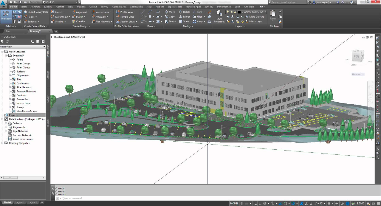
A Civil 3D course is a training program designed to teach individuals how to use Autodesk Civil 3D, a civil engineering design and documentation software. Civil 3D is widely used in the architecture, engineering, and construction (AEC) industry for tasks such as civil infrastructure design, land development, transportation design, and environmental projects.
Applications of Civil 3D Software in Civil Engineering

Civil 3D software is specifically designed for civil engineering professionals by Autodesk. It provides a range of tools and features that are invaluable for various tasks in civil engineering projects. Take a look at the key applications of Civil 3D software:
1. Roadway Design
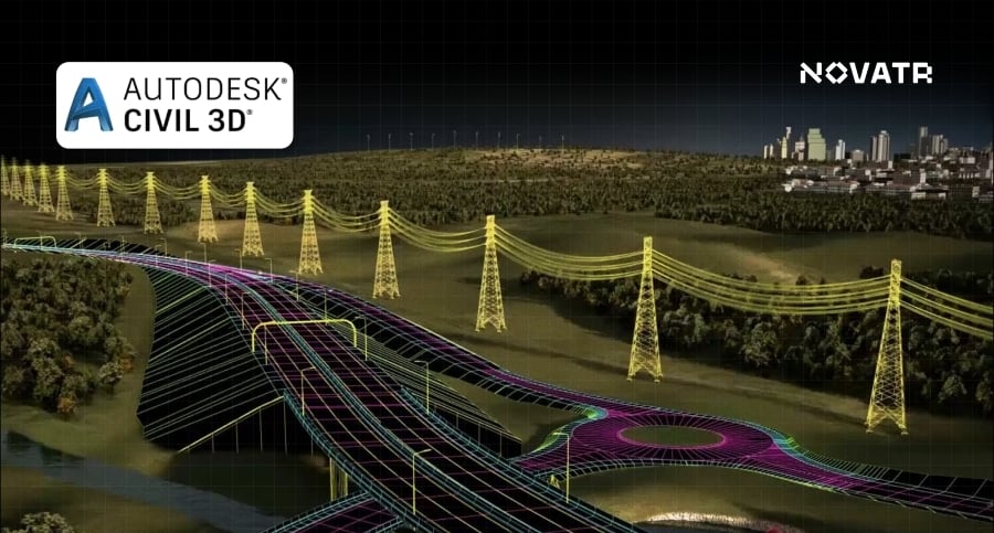
Civil 3D plays a major role in the designing of road centerlines and alignment profiles, including horizontal and vertical bends. Engineers can use the software to specify road elements, including lanes, shoulders, curbs, and walkways, thanks to the assemblies that facilitate road cross-section design. When creating the road surface and precisely grading the roadbed, the "Corridor" modelling tool is helpful.
2. Site Grading
In Civil 3D, grading plans entail changing the terrain as needed to accommodate project needs. The program aids in contour creation, cut and fill calculations, and site grading optimisation to reduce earthwork and guarantee a level site.
3. Collaboration
Project stakeholders can collaborate using tools offered by Civil 3D. Several team members work on a project simultaneously. Collaboration technologies facilitate effective data sharing, communication, and the resolution of design issues.
4. Quantity Estimation
Engineers can determine the materials required for construction using Civil 3D's quantity estimate tools. Estimating cut and fill volumes for grading, paving material amounts for building roads, and pipes and building quantities for utility networks are all examples of this. For project planning and procurement, these estimations are crucial.
Also Read : How Can BIM Help Mid-Level Experienced Civil Engineers Improve Their Salary
Benefits of Civil 3D
Civil 3D offers several benefits that enhance the efficiency, accuracy, and productivity of civil engineering projects. Below are some key advantages of using Civil 3D:
1. Save on Time and Money with Reduced Rework
A dynamic engineering model that links design and production drawing is used in AutoCAD Civil 3D projects. As a result, when you make a change to one part of the design, the entire design is updated, reducing drafting errors, the amount of time it takes to make design changes and the number of what-if scenarios that must be examined. Autodesk Civil 3D effectively converts the work process of a civil engineer into a powerful and user-friendly software environment, reducing errors while saving time and money.
2. Reduce Operation Costs with a Single Holistic Solution
AutoCAD Civil 3D 2008 covers various surveying and engineering project types, including site development, subdivision design, road rehabilitation, highway alignment design, environmental, and many more. Civil engineering, surveying, engineering technology, and drafting professionals can work on any project at any time without needing to become specialists in a variety of speciality products. A firm can also cut costs on training and support, simplify licence and subscription renewals, and lessen the need for data translation by deploying a single solution.
3. Easy Integration with AutoCAD
Civil 3D is based on the AutoCAD software. Thus, experienced AutoCAD users can work in a familiar environment with Civil 3D tools and processes. You can boost your civil engineering design and drawing productivity without a considerable learning investment by utilising existing AutoCAD-based production drafting techniques such as CAD standards, sheet set management, plotting, and so on.
4. Ramp-up Production
A drafting environment that is directly derived from the model is provided by AutoCAD Civil 3D. The style-based environment guarantees that the objects and annotations in the design match production requirements without requiring the user to be a CAD expert. Along with advanced drafting features like the brand-new Highway Sheet Generation Tool, Civil 3D also contains drafting tools tailored specifically for civil and survey work. These tools automate processes that would otherwise require multiple steps, greatly enhancing the effectiveness of production drawing.
5. Sync Your Design & Drafting
AutoCAD Civil 3D dynamically combines drafting elements with the engineering model to immediately update the annotation whenever the engineering model is changed. Tables, package labels, and alignment are a few examples of these components. The drawing scale and view orientation are also recorded by these clever labels and tables. When you alter the plan's scale from 1:50 to 1:100, the annotation will automatically update to keep the same plotted size. To ensure readability, the annotation of the objects rotates with the orientation of the plan's presentation.
Automatic updating aids in ensuring the accuracy of your final construction documents by cutting down on the time-consuming and expensive human editing of drafting items. To put it another way, AutoCAD Civil 3D essentially removes the need to redraft when design modifications are made. The model and Civil 3D annotation remain in sync once your drafting is complete.
Also Read : 3 Best Ways to Learn and Benefit from BIM in Civil Engineering
6. Enhanced Collaboration
To complete projects more quickly and with fewer errors, small and large project teams can take advantage of AutoCAD Civil 3D's scalable multi-user capabilities, which include the utilisation of AutoCAD external references, data shortcuts, and Autodesk Vault-based project assistance. More people can participate in the surveying, design, and planning production process by having simultaneous access to survey observations, points, surfaces, alignments, profiles, corridor models, and pipe networks.
7. Data Compatibility
When using AutoCAD Civil 3D, you may read and write MicroStation DGN drawing files, work with any DWG drawing file, and import and export project data from AutoCAD Land Desktop. Additionally, AutoCAD Civil 3D supports GIS data formats such as ArcView Shape, Export (E00), and LandXML data. You may also export model elements like parcels, pipelines, and alignments from AutoCAD Civil 3D in SDF format for use in GIS software like AutoCAD Map 3D or Autodesk Topobase. Last but not least, Civil 3D can link to top-tier data collectors made by companies like Leica, Trimble, and Carlson. Because AutoCAD Civil 3D's data interoperability enables a more integrated CAD and GIS solution, working with internal and external engineering and GIS departments or consultants is simple.
Also Read : Top 20 FAQs on BIM for Civil Engineers
Top 8 Online Civil 3D Courses to Enrol
1. Civil 3D and BIM Professional Course for Civil Engineers - Novatr
Placement Assistance: Yes
Duration: 7 Months
Build a future-ready career in construction with Novatr’s BIM Professional Course for Civil Engineers, a hands-on, industry-aligned program designed to help you master Building Information Modeling (BIM) from design to execution. Learn how top global firms use BIM processes and BIM tools to plan, coordinate, and deliver smarter, more efficient projects, while gaining the technical confidence to work on large-scale infrastructure and building developments. Recognized as one of the best institutes for Tekla structure certification, the program is designed to align learning with real-world construction practices.
Here’s what you’ll learn:
- 5+ industry softwares, including Autodesk Revit, Navisworks, Autodesk Construction Cloud: Docs, Coordination & Collaboration.
- Master essential plugins such as EF-Tools, DiRoots.One, pyRevit, ProSheets, Issue and Model Checker for Revit to automate documentation and improve precision.
- Learn complete BIM workflows, from digital design development, estimation & BOQ, and information modeling to clash detection, sequencing, and multidisciplinary coordination.
- Get hands-on experience working on real commercial and residential projects following ISO 19650 standards, guided by mentors from the global AEC industry.
- Develop professional construction documentation, audits, and deliverables aligned with international BIM practices.
Earn globally recognized certifications:
- Novatr Course Certificate, signed by the Academic Director.
- Autodesk User Certification, validating your command over Autodesk tools.
- NSDC Certificate, officially recognizing your BIM expertise.
- Optional Specialization Certificates, for learners who wish to deepen their skills in niche BIM applications.
2. Autodesk AutoCAD Civil 3D Course (With Certificate): For Engineers and Designers
Placement Assistance: No
Duration: Eight hours on-demand
Course Syllabus:
- Introduction to Civil 3D
- Working with Points
- Working with Surfaces
- Surface Volume and Analysis
- Alignment
- Working with Profiles
- Working with Assemblies and Sub-Assemblies
- Working with Corridors and Parcels
- Sample Lines, Sections, and Quantity Takeoffs
- Feature Lines and Gradings
- Pipe Networks
- Pressure Networks, Plan Production Tools and Data Shortcuts
The robust BIM solution, AutoCAD Civil 3D, is introduced to users in this course. A coordinated data model is created and visualised with the aid of AutoCAD Civil 3D's BIM solution. The design and analysis of a civil engineering project for its best and most cost-effective performance may then be done using this data model. The demands of professionals including engineers, surveyors, watershed and stormwater analysers, land developers, and CAD technicians who want to study and explore the usage and capabilities of AutoCAD Civil 3D in their respective sectors have been taken into consideration when creating this course.
3. Civil 3D Training Course: The Essentials - Infratech
Placement Assistance: No
Duration: Six Hours
Course Syllabus:
- Introduction
- Civil 3D Interface
- Civil 3D Styles
- Surveying
- Surfaces
- Parcels
- Alignments
- Profiles
- Corridors
- Pipe Networks
- Volumes
- Sections
Participants will study and utilise the tools provided by Civil 3D, the civil engineering version of AutoCAD, in this online Civil 3D course. From field data gathering to final design, Civil 3D gives customers the resources they need to complete a civil engineering project.
A series of lessons with step-by-step instructions and clear, succinct explanations are included in the course. Participants will comprehend the rationale behind each design decision. A user may typically finish this Civil 3D course in between 30 and 40 hours.
4. 3d Civil Course By Pluralsight
Placement Assistance: No
Duration: 3h 22m
Course Syllabus:
- Introducing the AutoCAD Civil 3D User Interface
- Examining the Civil 3D Toolspace
- Reviewing the Panorama and Object Viewer
- Exploring Object Styles
- Discussing Labels and Label Styles
- Reviewing Points
- Utilising Surfaces
- Creating Alignments and Profiles
- Exploring Corridors and Assemblies
- Discussing Pipe Networks
- Reviewing Gravity Pipe Networks and Pressure Networks
- Examining Feature Lines and Grading
- Working with Grading Creation Tools
- Creating and Subdividing Parcels
- Utilising Catchment Objects
- Introducing Data Shortcuts
Across these lectures, delve into the fundamental ideas and concepts of AutoCAD Civil 3D, a dynamic BIM solution for the civil engineering and surveying professions. This Civil 3D course will cover the fundamentals of the user interface, show a variety of items that may be represented in the program, and explain how the program can be used to expedite the design and preparation of plans for civil engineering projects. Viewers will have a fundamental grasp of AutoCAD Civil 3D's capabilities at the end of this course.
5. Master study in Project Management with BIM technology - E-construct
Placement Assistance: Yes
Duration: Seven Months
Course Syllabus:
- AutoCAD: 2D Interface
- AutoCAD 3D
- Revit-Architecture
- Revit-Structure
- Revit-MEP
- 4D Navisworks
- 5D Navisworks
- MS Project
- 6D & 7D Analysis in Revit
This Civil 3D course is an on-the-job learning program in which you get an opportunity to work on real-life projects with the technical team of E-Construct. The exam pattern of the course includes a written technical test for 200 marks, a practical exam on a Live project for 200 marks, a technical interview for 200 marks, and project assignments, attendance, professional attitude and habits for 200 marks.
Also Read : What is BIM for Civil & Structural Engineers, and How Do They Benefit From It
6. Autodesk Civil 3D 2026 Essential Training - LinkedIn
Placement Assistance: No
Duration: 10hr 14m
Course Syllabus:
- Navigating the User Interface
- Leveraging a Dynamic Environment
- Establishing Existing Conditions
- Modelling the Existing Terrain with Surfaces
- Designing with Alignments
- Displaying and Annotating Alignments
- Designing Vertically Using Profiles
- Displaying and Annotating Profiles
- Designing Roads Using Corridors
- Creating Cross Sections
- Displaying and Annotating Sections
- Working with Parcels
- Displaying and Annotating Parcels
- Designing Gravity Pipe Networks
- Designing Pressure Pipe Networks
- Displaying and Annotating Pipe Networks
- Grading: Designing New Terrain
- Analysing, Displaying, and Annotating Surfaces
A feature-rich design and documentation solution for civil engineering, design, and surveying is Autodesk Civil 3D 2026. As a civil engineer, surveyor, or designer, you may increase your productivity and effectiveness by becoming proficient with Civil 3D's top-notch tools. This Civil 3D course helps you get up and running with this sophisticated program. The course will be highlighting some of the 2026 version's new capabilities, before showing how to model a surface, arrange parcels, and create road geometry in plan and profile views.
7. Autodesk Certified Professional: Civil 3D for Infrastructure Design Exam Prep - Coursera
Placement Assistance: No
Duration: 22 hrs
Course Syllabus:
- Points, Parcels, Surfaces, and Grading
- Alignments, Profiles, Corridors, Pipe Networks
- Plan Production
This Civil 3D course from Coursera makes you work with parcels, surfaces, alignments, profiles, surfaces and point and point groups, as well as surveying instruments. Networks of pipes, sections, and pressure should be created. Use workflows to create view frames, sheets, and data shortcuts as well as note label styles. This equips you with the abilities and knowledge to pass the Autodesk Certified Professional: Civil 3D for Infrastructure Design test.
8. Civil 3D for Infrastructure Design Professional Certification Prep - Autodesk
Placement Assistance: No
Duration: 12 hr
Course Syllabus:
- Getting started
- See where you stand
- Points, parcels, and surveying, Part 1
- Points, parcels, and surveying, Part 2
- Surfaces and grading, Part 1
- Surfaces and grading, Part 2
- Alignments and profiles, Part 1
- Alignments and profiles, Part 2
- Corridors and sections
- Pipe and Pressure Networks
- Plan production and data management
- Course challenge exercise
- And Practice Test
This civil 3D course will help you to learn about certification test subjects including points, parcels, surveys, surfaces and grading, alignments and profiles, corridors and sections, pipe networks, plan production, and data management to develop the skills that professionals in the sector utilise. Use the courses, datasets, and activities as a guide to practise and review the test subjects independently. You may also take a practice test to assess your knowledge and be ready for the certification exam. It all comes down to preparation and practice.
Also Read : BIM Adoption in the Civil Engineering - Overview, Benefits & Factors Affecting
Conclusion
Being on the cutting edge of technology is not simply a competitive advantage in the constantly changing field of civil engineering; it is a requirement. In this process, Autodesk Civil 3D has emerged as a key platform for engineers and professionals to design, evaluate, and record civil infrastructure projects correctly and more quickly than before.
The top online Civil 3D courses to teach civil engineers the ins and outs of Civil 3D have been examined in this blog. These programs include a wide variety of information and abilities that are suitable for both novices trying to build a solid foundation and seasoned professionals hoping to advance their level of proficiency.
You can learn more about Civil 3D and its uses on Novatr's resources page. We are here to fully equip you with insights from industry experts in our 7-month-long BIM Professional Course for Civil Engineers.
FAQs
1. What skills do Civil 3D courses teach civil engineers?
Civil 3D courses teach surface modeling, alignments, corridors, grading, quantity estimation, and collaborative workflows that help engineers design and document infrastructure projects accurately and efficiently.
2. Is Civil 3D required for infrastructure and roadway projects?
Civil 3D is widely used in infrastructure and roadway projects because it supports intelligent modeling, automated updates, and accurate quantity calculations essential for modern transportation and land development work.
3. How long does it take to learn Civil 3D online?
Learning Civil 3D typically takes three to six months through online courses, depending on prior CAD experience, course structure, and the level of hands-on project practice included.
4. Are online Civil 3D certifications recognized by employers?
Yes, certifications from recognized platforms and Autodesk-aligned courses are valued by employers, especially when combined with project-based learning and practical infrastructure design experience.
5. Can beginners learn Civil 3D without prior AutoCAD experience?
Beginners can learn Civil 3D without AutoCAD experience, though basic CAD knowledge helps. Structured courses gradually introduce tools, workflows, and design concepts for smooth learning.

 Thanks for connecting!
.png)


.png)


.jpg)


