Understanding what is levelling is essential for professionals and aspiring civil engineers, aiming to excel in the AEC industry. It is one of the critical processes in civil engineering, ensuring precise measurements of the height differences for accurate project execution. It forms the foundation for creating stable design structures, planning drainage systems, and achieving design accuracy.
Read this blog to explore the types, methods, and instruments used in levelling, helping you enhance your technical knowledge and improve project overall understanding.
What is Levelling in Surveying?
Levelling in surveying is the process of finding the height difference between two or more points on the Earth’s surface. It helps determine elevations so that engineers can design structures with the correct alignment and slope.
Levelling is widely used in construction, highway design, earthwork, water supply systems, and infrastructure projects. The main goal is to establish a fixed reference point or benchmark that all future measurements can follow. This ensures uniformity and accuracy throughout the project.
Surveyors commonly use instruments like the dumpy level, automatic level, or digital level, along with a levelling staff, to take readings and calculate differences in height. These tools help produce reliable data that supports safe and efficient project execution.
This essential method plays a critical role in creating reliable and sustainable structures.
What is Reduced Level in Surveying?
Reduced Level in surveying refers to the vertical distance of a point from a reference datum, typically the sea level or a chosen benchmark. It is used to determine the height of different points on a site relative to the established base level. In levelling in civil engineering, reduced level is crucial for planning elevations, designing drainage systems, and ensuring accurate construction measurements. By using reduced levels, surveyors can make informed decisions about the topography of the land.

Types of Levelling in Surveying
Here is a list of crucial types of levelling in surveying that every civil engineer should know.
-
Simple Levelling
It is the most basic method, where the instrument is set up between two visible points, ideal for short distances and provides a simple way to measure height differences in nearby areas. This type of levelling in civil engineering is often used for small-scale projects.
-
Differential Levelling
This method involves transferring levels between two distant points using multiple setups. It is widely used for precise elevation measurements in large-scale projects like roadways and dams. Differential levelling is one of the most reliable types of levelling in surveying, ensuring accuracy across long distances.
-
Fly Levelling
This type of levelling connects benchmarks over long distances. Commonly used in preliminary surveys, it is an efficient method for establishing temporary benchmarks quickly during construction.
-
Profile Levelling
This type creates elevation profiles along a fixed line, such as a roadway or pipeline path. It provides data for designing gradients and ensuring proper flow in infrastructure projects.
-
Reciprocal Levelling
This method is used when levelling across obstacles like rivers or valleys. Measurements are taken from both ends to reduce errors caused by distance and atmospheric conditions, ensuring accurate results.
-
Barometric Levelling
This advanced method uses atmospheric pressure differences to calculate elevations. It is less precise but useful in rugged terrains where traditional instruments are challenging to use.
-
Trigonometric Levelling
By measuring vertical angles and distances, this method calculates elevations. It is often used in hilly areas and is a valuable tool in modern surveying. Trigonometric levelling plays a significant role in terrain-specific and large-scale projects.
-
Dumpy Level
It is a simple yet vital instrument used in direct levelling to establish height differences. It is ideal for construction sites and infrastructure development.
-
Automatic Level
This instrument self-adjusts to maintain accuracy, making it easier and faster for surveyors to measure elevations, especially on uneven terrains.
-
Tilting Level
This allows minor adjustments for accuracy, making it versatile in situations requiring precision, such as building layouts or drainage systems.
-
Direct Levelling
It is the most commonly used method, where a level and staff are employed to measure vertical differences between points.
Principles of Levelling in Surveying
These are essential to ensure accurate and reliable measurements in land surveying. Here are some of the vital principles that you should know.
-
Horizontal Line of Sight
In levelling in civil engineering, measurements are made using a horizontal line of sight to minimise errors due to slope or curvature. The instrument used, such as a level or a theodolite, must be set up correctly to maintain this reference.
-
Use of Instruments
Various instruments like the dumpy level, automatic level, and tilting level are used in levelling. These instruments help measure height differences and ensure the horizontal line of sight is maintained throughout the process.
-
Benchmarking
Surveyors establish reference points or benchmarks at known elevations. These benchmarks serve as the foundation for all levelling operations, ensuring consistency and accuracy across the project.
-
Compensation for Instrument Errors
Instruments need to be calibrated regularly to account for minor errors that could distort results. This principle is essential in maintaining the accuracy of the data obtained during levelling in surveying.
-
Closure of Levelling
The final principle involves checking the accuracy of the measurements by closing the levelling loop. This is done by returning to the starting point to confirm that the initial measurements align with the final results, ensuring there are no significant errors in the procedure.

Objectives of Levelling in Surveying
Objectives of levelling in surveying ensure the proper alignment and planning of construction projects, making it essential for precision in civil engineering. Explore the crucial objectives:
-
Establishing relative heights of points to ensure accurate construction and design.
-
Creating a horizontal reference line, crucial for precise measurements in levelling in civil engineering.
-
Determining elevations in relation to a known benchmark, ensuring reliability in surveys.
-
Supporting construction projects by aligning structures like roads and bridges with the natural landscape architecture.
-
Assisting in the creation of contour maps to represent accurate topographical details.
Instruments Used in Levelling Surveying
Each levelling instrument serves a unique purpose and plays a crucial role in ensuring the accuracy of elevation measurements. Understanding the specific requirements of a project helps in selecting the appropriate instrument for the project. Below are some of the most commonly used types of levelling instruments.
-
Auto Level
It is an advanced version of the dumpy level that automatically adjusts to ensure the instrument is perfectly horizontal. This feature reduces human error and increases accuracy, making it ideal for larger surveying projects like infrastructure developments. It is typically used for establishing straight lines and elevation differences.
-
Dumpy Level
It is one of the most widely used levelling instruments in surveying, which is a simple and precise tool consisting of a telescope mounted on a horizontal axis. It is used to measure the difference in height between various points and to establish a horizontal reference line. The dumpy level is particularly helpful in construction of roadworks.
-
Digital Level
This instrument uses electronic sensors to measure height differences and display the results digitally. This type of level is known for its high precision and ease of use. It’s especially valuable for surveying tasks where detailed measurements are required.
-
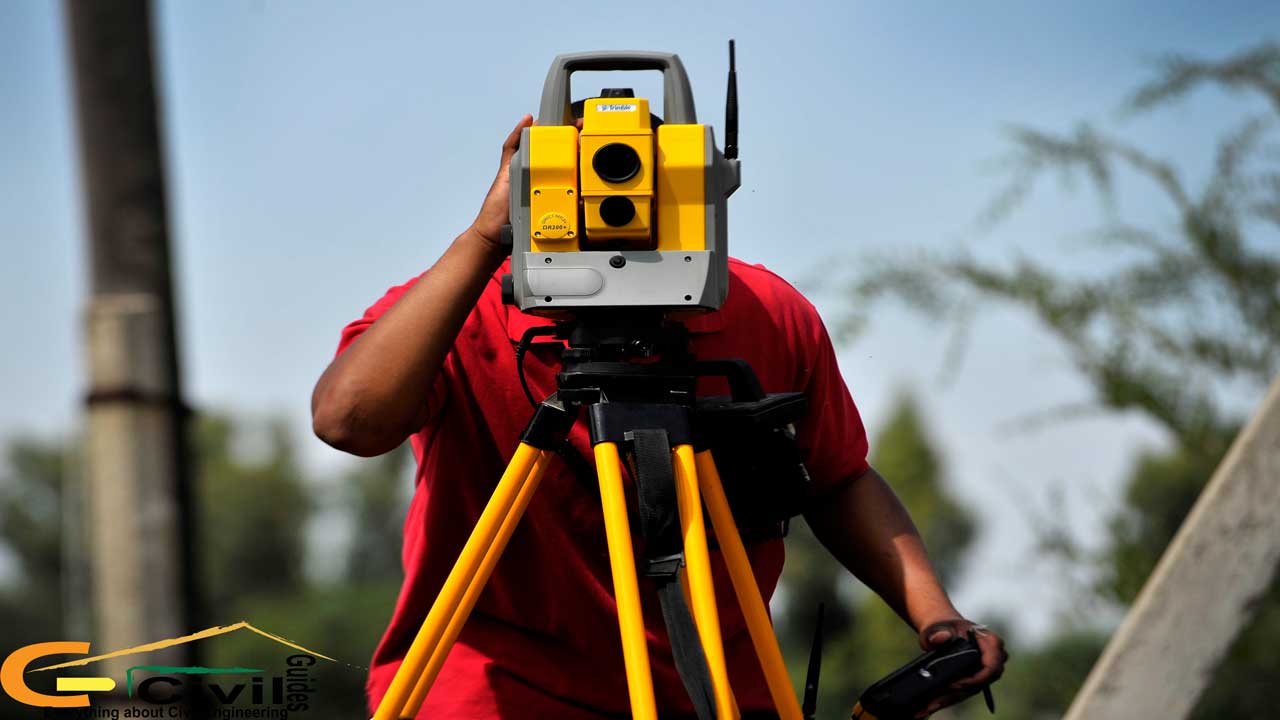
Theodolite
While primarily used for angle measurement, theodolite can also be employed in levelling surveys to measure horizontal and vertical angles for determining the slope or difference in elevation. It is a versatile instrument often used in large-scale surveying operations.
-
Tilting Level
It is similar to the dumpy level but features a tilting mechanism that helps fine-tune the horizontal adjustment. This instrument is suitable for precise horizontal alignment and is commonly used in large-scale civil engineering projects.
-
Levelling Staff
It is not exactly an instrument in itself but works in tandem with the above levelling instruments to measure vertical height differences. Made from a telescopic or graduated pole, the levelling staff is placed at the point being measured, and the surveyor reads the height using the levelling instrument.

Methods In Levelling in Surveying
The Levelling method plays a significant role in levelling in civil engineering, depending on the requirements of the project. Below are some of the most commonly used methods in surveying.
-
Direct Levelling
One of the simplest methods, where a levelling instrument is used to establish a horizontal line of sight. The difference in height between two points is measured using a levelling staff. This method is commonly used for short-distance measurements.
-
Differential Levelling
In differential levelling, the difference in elevation between two or more points is measured by using a levelling instrument and staff. This method helps in determining the reduced level (RL) at different locations, often used in creating profiles and cross-sections for construction.
-
Fly Levelling
It is a quick method used for rough levelling. It is typically employed to establish approximate heights over long distances. Although less precise, it is helpful in initial survey work before finer adjustments are made with other methods.
-
Trigonometric Levelling
This is used to determine the height difference between points based on observed angles and distances. It is especially useful when measuring over long distances or when physical access is difficult.
Conclusion
Levelling in surveying is one of the crucial steps for accurate land measurement and construction planning. Whether you want to enhance your knowledge by exploring its types or using specific instruments, mastering it will ensure efficiency in construction projects. Civil engineers who want to elevate their skills to the next level should consider the BIM Professional Course by Novatr. This course not only enhances the understanding of surveying techniques, but also integrates them into modern workflows, preparing you for challenges faced in the industry.
To stay updated with the latest trends in the AEC industry, you can always check out Novatr’s Resource Page!
Frequently Asked Questions:
1. What is a staff reading in levelling?
A staff reading is the measurement taken from the levelling staff through the instrument’s telescope. It shows how high or low a point is compared to the line of sight. A clear and accurate reading helps surveyors calculate reduced levels and height differences.
2. Why is levelling important in construction?
Levelling is important because it ensures structures are built at the correct height and slope. It prevents issues like uneven foundations, waterlogging, drainage errors, and structural imbalance. Proper levelling also helps align roads, pipelines, and bridges with the natural ground profile.
3. What is the main function of levelling?
The main function of levelling is to measure elevation differences between points. This helps engineers design safe, accurate, and well-aligned construction projects such as roads, buildings, and drainage systems.
4. What is the main principle of levelling?
The main principle is maintaining a horizontal line of sight when taking readings. This prevents sloping-related errors and ensures accurate height calculation. Surveyors also rely on benchmarks and instrument checks to maintain precision.
5. What instruments are used for levelling on site?
Common instruments include the auto level, dumpy level, digital level, tilting level, and theodolite. They help surveyors keep the line of sight horizontal and measure height differences accurately using a levelling staff.
Was this content helpful to you


